JEVREJSKA STREET

Today’s Jevrejska (Jewish) Street is the end of the old Jevrejska Street after it was cut in half by the construction of Marsal Tito’s Boulevard, as well as a part of the old Futoska street that continued on it, to the intersection with Boulevard Oslobodjenja, constructed at the end of 1960s. The street is located on the route leading from the city to Futog, which two hundred years ago was more important than Novi Sad and the seat of a County.
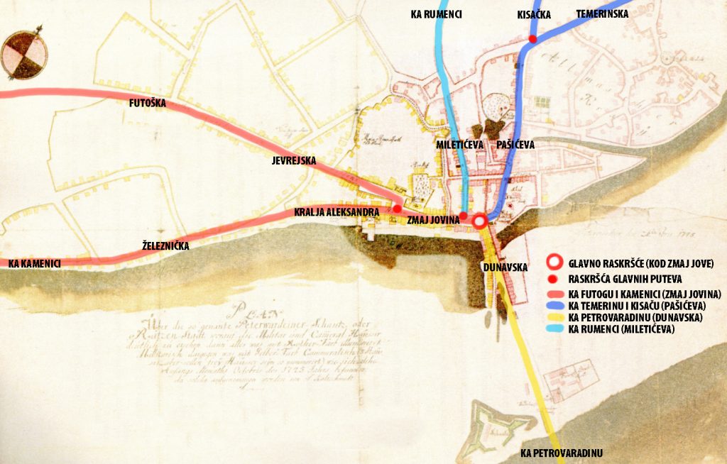
The city of Novi Sad was built at the crossroads of 3 roads that met at the Zmaj Jova’s monument in front of the bishop’s palace. From the crossroads to the west, through Zmaj Jovina (Main Street), there is a road to Futog and Kamenica, which diverge on today’s Trg Slobode, at the City Hall, to the left (Kralja Alesandra Street) and to the right (old Jevrejska and Futoška Street). From the crossroads to the south, through Dunavska Street, there was a road to Petrovaradin over the pontoon bridge and further to Belgrade, and to the north, through Pašićeva, a road to Temerin (Temerinska Street), and further to Budapest. At the end of Pasiceva street, there used to be an old Inn called “At Three Crowns”, just as the road turned to Temerin, and also the road to Kisac (Kisacka Street) used to separate here. Somewhere in the middle of Zmaj Jovina Street, to the north, another old road separates – the road to Rumenka which leads through Miletićeva Street, then Vojvode Bojovića and Kralja Petra, to Rumenačka Street.
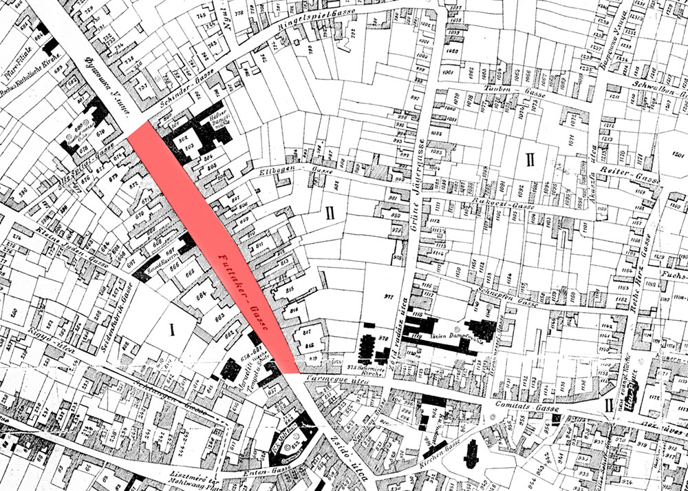
Today’s Jevrejska Street on the city plan from 1745 was part of the former Futoška Street, one of only 9 streets marked on this map, and stretched from the entrance to the city to Trg Slobode. On Sauter’s city plan from 1889, we see the old Futoška Street that stretched to the synagogue, and further to Trg Slobode the old Jewish Street continued. So, Futoška Street flows through the old Jewish Street(part of today’s Jewish Street and Theater Square) into the Trg Slobode Square, where it merges with Kralja Aleksandra Street and continues as Zmaj Jovina Street.
On Sauter’s plan, we see the most important buildings in the city marked in black, with inscriptions. In Jevrejska Street three buildings are marked: The Sinagogue, The K&K military command building at the corner of Jevrejska and Poštanska Street, and the old Customs House, now the Cadastral building) at the corner of Jevrejska and Vase Pelagica Street.

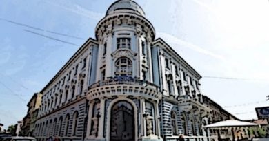
The synagogue complex on Sauter’s plan is the 4th synagogue in the history of Novi Sad, and the fifth was built on its place between 1906 and 1909 and designed by a Pest architect Lipot Baumhorn, who also designed the Savings Bank Palace on the Trg Slobode Square.

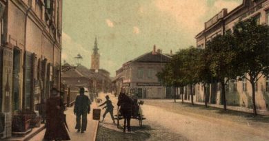
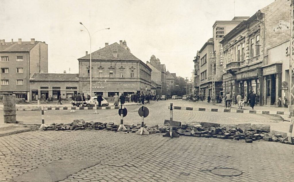
The following picture shows the K&K military command building on the corner of Jevrejska and Postanska streets, around 1960, before the demolition of a series of houses and on the right side of the old Jevrejska Street due to the construction of the Marsal Tito’s Boulevard.
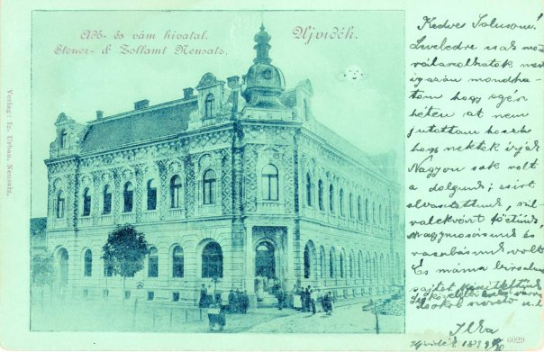
Today’s Cadastral building on the corner of Jevrejska and Vase Pelagic Street, built as a Customs House at the end of the 19th century:
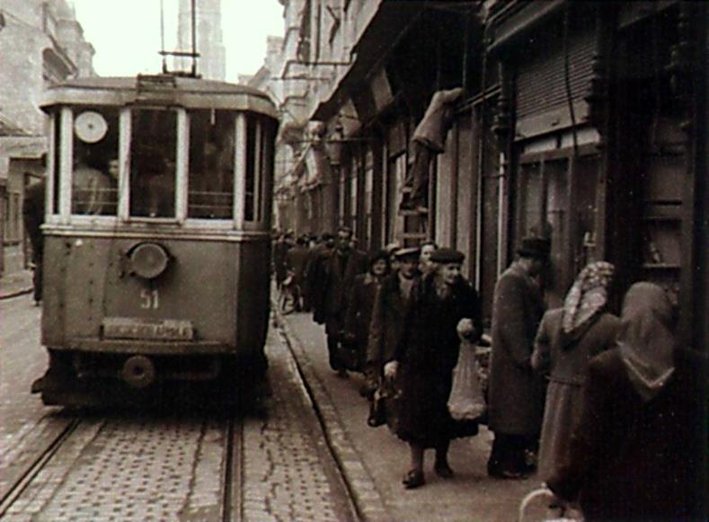
This is one of the streets used by trams from September 30, 1911 until the same day in 1958, when it was abolished. Line one, known as the white line from Futoška Kapija to Temerinska Street, passed here. This line went from the spa and hospital along Futoška Street, Jevrejska, Zmaj Jovina next to Vladičin dvor and then Pašićeva and Temerinska to the canal, where the line ended.
Today’s Jevrejska Street used to be part of the old Futoska Street on the oldest plan of Novi Sad from 1745. A part of the street from Trg Slobode to the synagogue was changed to Jevrejska Street at the end of the 18th century, after in one of the first decisions of the newly established Magistrate: Jews were given a deadline to sell their houses and settle in a certain place, in Jevrejska Street. The name Futoška Street remained until the 1930s when it was changed to Kralja Petra II, together with Jevrejska Street. In the period from 1941 to 1944, Rakoczy Ferenc II utca, Futaki ut, and 1944-2000: JNA Street from Trg Slobode all the way to the Barracks on Futoški put, and from there first Edvard Kardelj Boulevard, and later Revolution Boulevard. In the 1990s, the names Jevrejska and Futoška streets and Futoški put were restored.