TRG MARIJE TRANDAFIL

This square, the former Novi Sad’s Grain Market Square, is one of the oldest parts of the city, and on the city plan from 1745 it was a part of today’s Pasiceva Street, then called “Vel’ka čaršija”, (one of only 9 registered street names on this oldest plan – 2 in Serbian, 1 in Hungarian and 6 in German). On the square itself, on the site of the Matica Srpska building, there was a Turkish Han, which together with the street name may indicate there was a settlement here during the Turkish reign before the arrival of the Habsburgs.
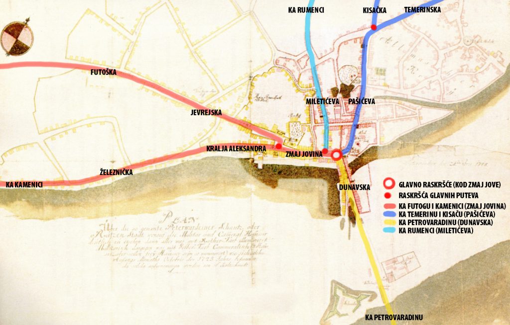
On the next engravement from 1698, at the end of the earth bridge (on the site of today’s Danube Street) on Petrovaradin direction, we see the road splitting into 3 streets that formed a town: straight ahead was today’s Pasiceva, on Temerin and Budapest direction, to the left Zmaj Jovina in the Futog direction, and to the right the Zlatne grede Street, which ended in the swamp.

As we can see, Novi Sad was built at the crossroads of 3 roads that met at the Zmaj Jova’s monument in front of the bishop’s palace. From the crossroads to the west, through Zmaj Jovina (Main Street), there is a road to Futog and Kamenica, which diverge on today’s Trg Slobode, at the City Hall, to the left (Kralja Alesandra Street) and to the right (old Jevrejska and Futoška Street). From the crossroads to the south, through Dunavska Street, there was a road to Petrovaradin over the pontoon bridge and further to Belgrade, and to the north, through Pašićeva, a road to Temerin (Temerinska Street), and further to Budapest. At the end of Pasiceva street, there used to be an old Inn called “At Three Crowns”, just as the road turned to Temerin, and also the road to Kisac (Kisacka Street) used to separate here. Somewhere in the middle of Zmaj Jovina Street, to the north, another old road separates – the road to Rumenka which leads through Miletićeva Street, then Vojvode Bojovića and Kralja Petra, to Rumenačka Street.
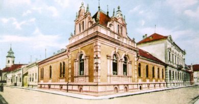
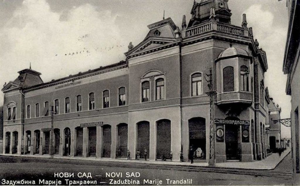
At the beginning of the square, to the right, on the site of the former Turkish Han, which was completely destroyed in the bombing of the city in 1849 during the Revolt, is the Matica Srpska building, the endowment of the benefactress Maria Trandafil. It was built as the “Maria Trandafil Institute for Serbian Orthodox Orphans in Novi Sad”.
Across the street is the building of the Serbian primary school, better known as Miletić’s primary school, built in the style of classicism, with a base in the shape of the capital letter “E”. It was built in 1871/74 in the parish land of the Nikolajevska church, based on the project of Đerđe Molnar, “at the expense of the town municipality” according to the decision of the General Assembly of the Magistrate from 1869.

This is one of the streets used by trams from September 30, 1911 until the same day in 1958, when it was abolished. Line One, known as the white line from Futoška Kapija to Temerinska Street, passed through the Trg Marije Trandafil. This line went from the spa and hospital along Futoška Street, Jevrejska, Zmaj Jovina next to Vladičin dvor and then along Pašićeva Street and Temerinska to the canal, where the line ended.

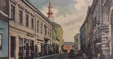
This square was the first part of today’s Pašićeva Street under the name Velika čaršija, Ćurčijska ulica (Kurshnengasse, Szucs utca), and at the end of the 18th century when the grain market was moved here from Zmaj Jovina, it was named Žitni trg. This name did not change even during the wars, until after World War II, when the name of the square was changed to Hero Toza Markovic Square, and since 1990s, Maria Trandafil Square, as it is called today.